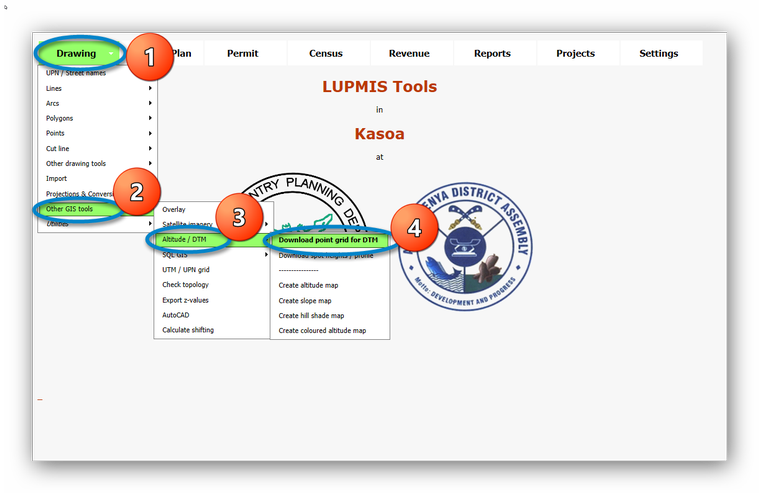
8.2.13.2 Altitude/DTM - LUPMISManual
Main menu:
8.2.12.2 Altitude / Digital Terrain Model (DTM)
- a) Download Point Grid for DTM
There are many ways to create a Digitial Terrain Model (DTM). The easiest might be from a grid of altitude points, which can be downloaded from Google through a Google API: Drawing Tools > Other GIS Tools > Altitude / DTM > Download point grid for DTM:
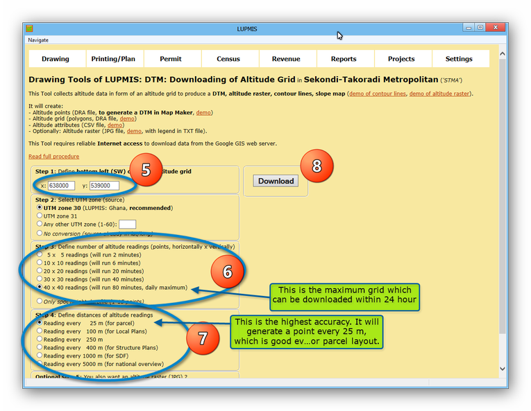
> Enter the UTM coordinates of the bottom left (SW) corner of the grid to be downloaded > Select the number of readings (points). The maximum is approx. 1600 per day, i.e. a grid of 40 x 40 points, which takes some 80 minutes. > Select the distance between the points, which is determined by the scale of your work > Download, and wait the estimated time.
If your area is larger than the 40 x 40 x points, you have to continue after 24 hours.
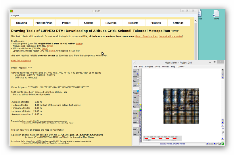
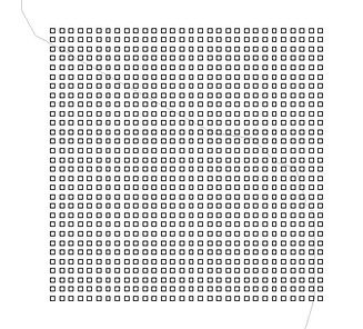
The result shows in the Map Maker windows, described in LUPMIS:
- b) Create DTM
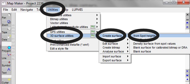
In Map Maker, you can now create a DTM from these altitude grid points: Utilities > 3D surface utilities > Create surface > from Spot heights > Select ...alt_points... file > Z values are NOT stored in a separate database > Settings > Use closest value in 6 directions > Cell width: Distance between points in point DRA file> Save Surface > Define name of TER file > Save.
- Create Contour Map
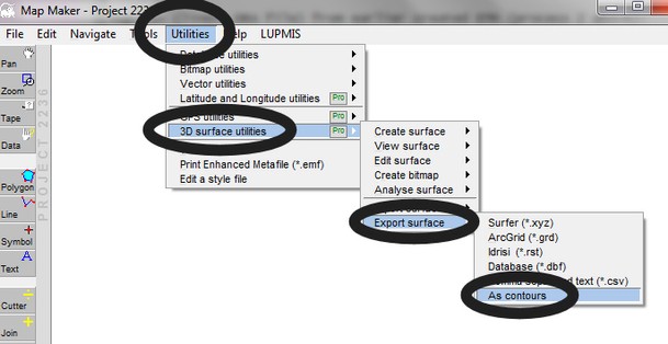
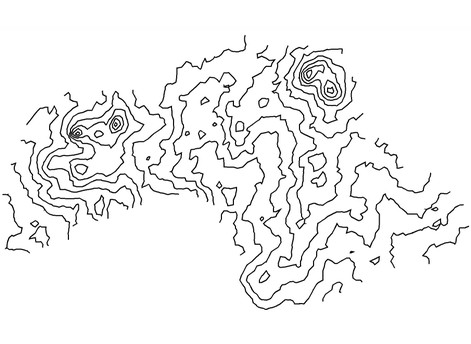
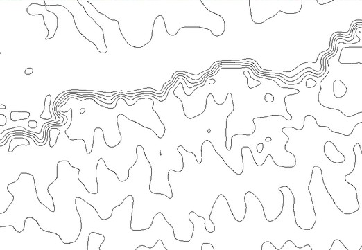
- c) Create Contour Map
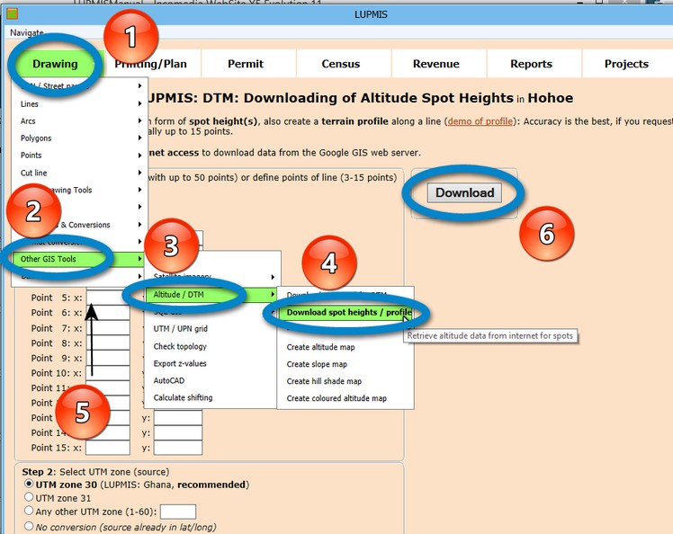
- d) Download Spot Heights / Profile
You can also download spot heights for individual mapping or an altitude profile. This is limited to a number of 50. You can either create a line DRA file or enter the points manually: Drawing Tools > Other GIS Tools > Altitude / DTM > Download spot heights / profile > Select DRA file or enter point coordinates > Download:
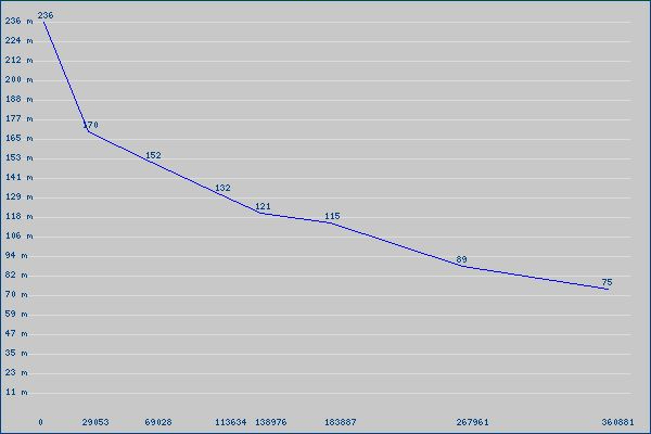
Example for a profile (e.g. road profile):
- - - - -
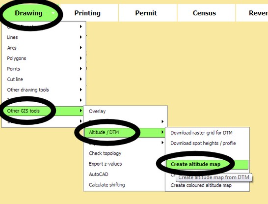
Once you have a DTM, you can create a variety of altitude-related maps:
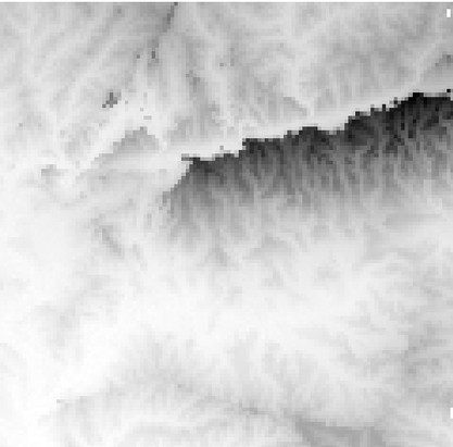
- e) Create Raster Altitude Map
Drawing Tools > Other GIS tools > Altitude / DTM > Create altitude map
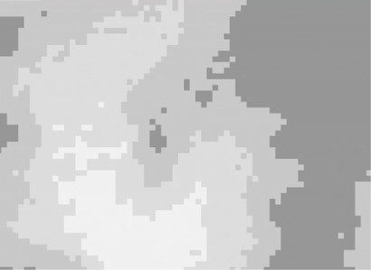
Examples of result:
- f) Create Slope Map
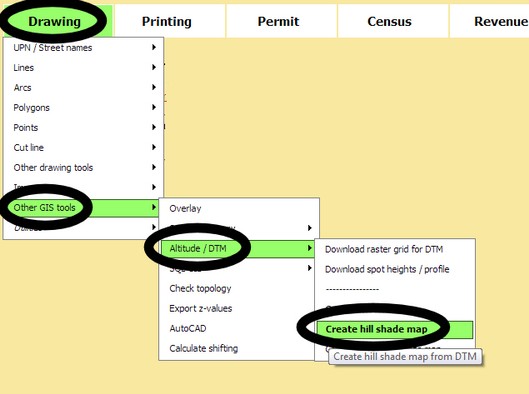
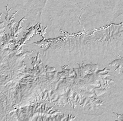
- g) Create Hillshade Map
A hill shade map (raster, TIF file) can be created from altitude bitmap (TIF, created from DTM in Map Maker, recommended) or from JPG file (created in LUPMIS): Drawing > Other GIS tools > Altitude / DTM > Create hill shade map
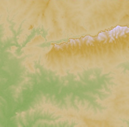
- h) Create Coloured Altitude map
An alternative coloured altitude map (raster, TIF) can be created from altitude bitmap (created from DTM, in Map Maker), alternatively from JPG file (created in LUPMIS): Drawing > Other GIS tools > Altitude / DTM > Create coloured altitude map
Alternativ approach in Map Maker to create altitude bitmap: Utilities > 3D surface utilities > Create bitmap > Altitude: Define colours by Colours > by Palette.

