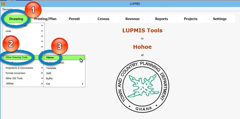
8.2.9 Other Drawing Tools - LUPMISManual
Main menu:
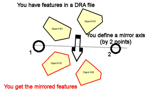
a) Mirrow
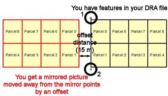
You can also define an 'offset', i.e. a distance, from where the mirrored file should be placed (see example below).
You can also define an offset:
b) Prolong (extend)
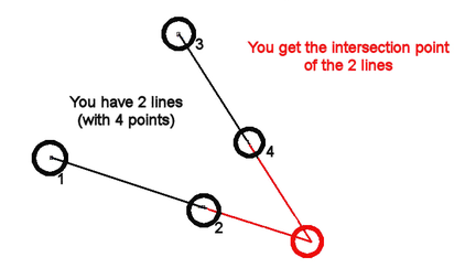
With the 'prolong' tool you easily find the intersection between 2 lines. The lines are extended to the point, where they meet.
OR: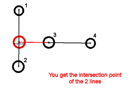
c) Template
A template is a pre-designed planning scheme, which has been carefully planned and designed, and which can easily be placed in your planning scheme. You have to specify the anchor point at the northwest corner; you can also define a rotation angle.
If you want to move the template to a slightly different location, you can easily drag or rotate it in Map Maker with standard Map Maker tools or with the 'Shift' drawing tool.
First test templates are available. In future, more templates will be distributed.
Note: Don't confuse these 'planning templates' with Map Maker's ' map templates' for final map production.
Technical note: These planning scheme templates have following requirements:
Good example and following all planning standards
GIS data quality-controlled (with correct topology, classification, all snapped etc)
All x values > 999 (raw template should be created in Map Maker at higher x/y coordinates)
All coordinates in UTM
All labels start with 'Object' (in Map Maker: Live layer actions > IDs and labels > Amend labels and IDs > Renumber IDs starting from 1, and Add prefix: Object , then Set display labels equal to IDs)
File in xy format, with coordinates in UTM (in Map Maker: Utilities > Vector utilities > Export files > to Map Maker xy file > ... > Simple co-ordinates / Metres >...)
xyt extension (renaming through Windows Explorer)
File reside in folder C:\LUPMIS\Permits\Support (copying can be done through Windows Explorer)
Top left as starting point (has to be done manually in the xyt file by moving the most northwest polygon to the first place)
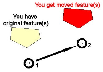
d) Shift
Shifting a DRA file means to move it to a new location. This 'shift' can be defined either by 2 points (from point A to point B) or by a shifting definiton of distance / bearing.
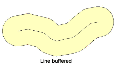
e) Buffer
The buffer tool is an alternative to the in-built Map Maker function of buffering. At normal work, it is recommended to buffer inside Map Maker live layer, either from Edit > Show Selection Manager > Action or after digitizing a line > Actions > Create buffer zone.
f) Cut half
This is a rudimentary tool to cut a polygon into 2 halves either in horizontal or vertical direction. This direction is automatically determined by the longer extension of the polygon.
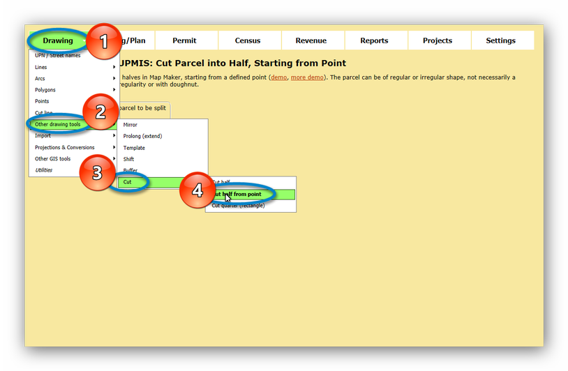
g) Cut Half from Point
This tool lets you split one polygon into 2 halves, where you define the point, from where it should be split. You set a point at or close to its boundary.
Drawing > Other drawing tools > Cut > Cut half from point:
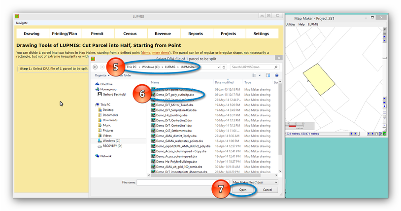
A new window will open, where you can select the DRA file with the one polygon (parcel) to be split, see example on the right, below:
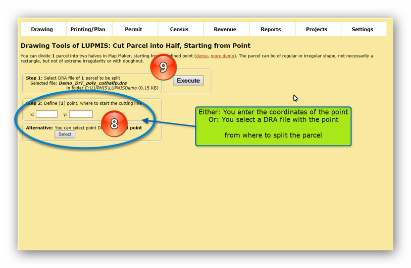
After pressing 'Open', you return to main LUPMIS, and choose now the reference point, from where to split. This can be entered either in coordinates (x and y in UTM) or as a point DRA file.
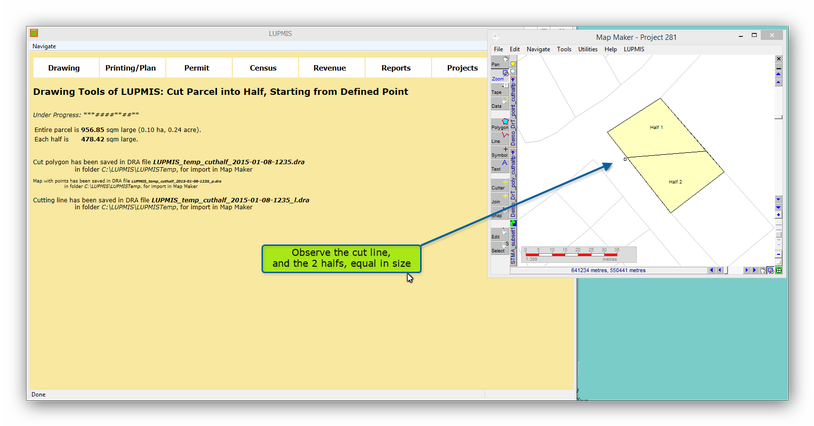
The result are two polygons, each of the same size, equal to half of the previous polygon:
h) Cut Quarter (Rectangular)
This tool cuts a polygon in four quarters.

